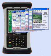
DC4 - Data Collection Software
|
Calling on the experience gained when developing the first data
capture software to be used in the UK (both CHART and RMMS), DC4
utilises the latest software and hardware technology and is truly multi-functional.
|
|
Options are now available to locate items or defects using the
in-built GPS capability. These can include the location of the
nearest Section, nearest Marker Post and the estimation of
chainage within normal GPS accuracy. The inclusion of photographs
within the data is also a standard option.
Contact us to download a fully functional demonstration copy. The demonstration will run in Windows or on a Pocket PC.
Contact us to download a fully functional demonstration copy. The demonstration will run in Windows or on a Pocket PC.

