News
|
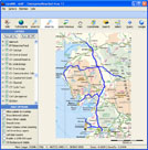
As part of Colas’s continuing maintenance contract in Portsmouth, JRCS has been retained to undertake Service Inspections on their full network every 6 months. This entails a broad-brush assessment of Carriageway and Footway condition in each 20m sub-section of the network together with reporting the condition of all other highway assets contained in their Inventory database. JRCS are using their internally developed data collection software together with GeoMM to manage the surveys and, at the moment, passing the data on as shape files to be imported into their GIS. As changes and improvements continue to be made to their roads, there is a facility to update selected areas of the Inventory as the need arises. |
|
|
John Reid has been fully accredited to undertake Audits on the UKPMS visual surveys for DVI, CVI and FNS. As well as continuing to Audit the surveys undertaken in Portsmouth each year, JRCS has completed several Audits for other companies undertaking this work. |
|
|
Mouchel Ltd who operates the Highway's Agencies Area 3 covering Motorways and Trunk Roads join the longstanding clients at Areas 1 and 13 to become our latest GeoMM user. This is in addition to the Peterborough and Cirencester DBFOs contracts, operated by their sister company, EnterpriseMouchel Ltd came on-board earlier in the year. From 2013 they will be managing their Network, Inventory, Inspections and Defects using GeoMM and collecting their data with DC4Invent and DC4Inspec. JRCS Ltd has supplied their system ready-loaded with their network details and routes and also loaded the existing inventory data onto maps provided by them. |
|
|
As a follow-up to the data previously supplied, covering the town centres of both Windsor and Maidenhead, a further 680 kilometres of both rural and urban roads in the Royal Borough of Windsor and Maidenhead (RBWM) were successfully surveyed between September 2011 and June 2012 and a full inventory of 50 items recorded on background maps. The data was provided to the client in July 2012 as shape-files which they have now loaded into their in-house GIS. As well as being the home of the well-known tourist features of the Royal Borough, this year RBWM hosted the Olympic Rowing events at Dorney Reach on the river Thames. |
|
|
To complete the accreditation of their Highway Inspectors, the final 2 personnel were assessed for competence by John Reid, who accompanied them on one of their scheduled Safety Inspections, in October 2011 and added to the previous 9 inspectors accredited in 2010. The procedures they followed regarding the recognition, classification and recording of defects were checked against the requirements of the CCC COP and Manuals together with the response times and actions they recommended for each defect encountered. A certificate of competence was issued for those working in accordance with the requirements, which on this occasion was 100% of those assessed. Further assessment and accreditation will be undertaken in the future for new staff or to ensure that Inspectors are continuing to meet the required standards. In October 2011, a Review Session attended by the Inspectors was held to discuss issues that had arisen during the period since the initial training courses and these were discussed and documented for future consideration and action where needed. Also this year, the procedures were adapted and adopted by the Street Care section within CCC which has responsibility for Bus Stations, Car Parks and Unadopted Housing Footways and Parking Areas. The previously prepared Code of Practice and Inspectors Manual were amended to reflect their similar but slightly different needs and as before, their Inspectors received training and subsequent accreditation. |
|
|
For the third year running JRCS Ltd has been employed by Colas Ltd to undertake an audit of CVI, DVI and Patching surveys carried out on the roads in the City of Portsmouth. The work involved checking a sample of the data submitted to Colas to ensure it met the requirements of the UKPMS surveys. |
|
|
Following feedback from the users at Areas 1 and 13, we have added some new features to GeoMM this year to help them with their on-going management of the networks within their areas. The new Scheme Manager allows selection of CAT-2 defects by section, XSP or chainage. Additionaly, the defects can also be selected from the map. The new ArcGIS link allows Inventory attributes and GIS data to be automatically exchanged between GeoMM and ArcGIS. |
|
|
The company that manages the HA's roads in Area 1, Area 3 and Area 13 is looking at GeoMM to address its requirements for their contract. Already used in 2 of the areas by the previous incumbent, GeoMM and DC4 has been transferred to the new commissions and continues to provide data related to Inventory, Inspections, Visual Surveys and Lamp-Scouting. They have imaginatively linked several of their map-based layers from their GIS so that information is displayed along-side their Inventory and Defect data, greatly enhancing its use. Hopefully GeoMM will continue be expanded with the addition of other applications for both highway and lighting management this will include Long-Stop Condition Requirement (LSCR) and a potential enhancement to their excellent in-house Watchman system. |
|
|
LB Ealing commissioned JRCS to collect data related to their Parks Maintenance contract which is due to be let this year. The positions of 'Grassed Areas', 'Flower Beds', 'Path Edges' and other items required for maintenance were all located accurately on their map background and loaded into MapInfo to produced their Schedule of Rates and individual plans of each Park, Housing or Highways area. The work was undertaken by a team of 3 surveyors who, although disrupted by the winter weather, completed their task within the specified period. |
|
|
The full lengths of the 2 latest Toll Roads opened in Ireland, the SouthLink N25 Waterford By-pass and MidLink M7/M8 near Portlaoise, were both mapped by JRCS in 2010. A convention RMMS Inventory Survey was required in each case with the added benefit of all items being recorded spatially. Linear items were recorded at their Start, End and Change (Intermediately) points and plotted as running parallel to the road centre-line. |
|
|
JRCS has recently mapped all items in Windsor and Maidenhead Town Centres. Everything on the streets down to individual utility covers was plotted with their attributes and supplied to the client as MapInfo ready files. The survey took about 10 weeks in total and 40% of the data collected was the covers. |
|
|
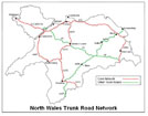
The authority that manages the Trunk Road network in North Wales, NWTRA is now using DC4 to collect their Detailed Inspection data and loading it into their existing database. Running on the latest Nomad hand-held computers under Windows Mobile 6.1, the software utilises GPS for Section Selection, Defect Location and Route Completion as well as enabling photographs of defects to be embedded into the output. One of the authorities who is part of NWTRA is also using DC4 for Inventory collection. |
|
|
When you are out on the streets, you never know who is watching! But where are we? Type 'Collingwood Road, Portsmouth' into Google Maps and drag the Streetview 'man' to the east end and you'll see. By the way GeoMM now embraces these 2 Google features into it's basic structure and can use them to display Network and Inventory details. Particularly useful for road markings and signs I think! |
|
|
Highways Agency Area MAC9, operated by Amey LG, has become the latest agent to take up both DC4 and GeoMM. They are utilising Nomad hand-held computers to collect the data and can transmit the files to a protected area on the JRCS website directly from these devices. When they log in to their GeoMM management system, the files are automatically downloaded and compiled into works orders for issue to their works section and transfer to their internal works ordering software. All data can be accompanied by OSGR co-ordinates obtained from the in-built GPS receiver and optionally a linked photograph of each defect. These are plotted on their background maps for easy management. |
|
|
We have been working with Carmarthenshire CC since 2004 and in early 2010 reached the end of our prime objective. The overall project included:
|
|
|
The Inventory survey of all roads within Portsmouth City, commissioned by Colas Ltd as part of their ongoing PFI commitment, was completed in July last year. An integral part of this contract was the production of a comprehensive Inventory Manual to act as both a specification for the work and an aide-memoire for the surveyors. It will prove useful in the future when updates are undertaken. A copy of this Case Study can be downloaded from the download page. |
|
|
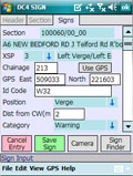
A new version of DC4 was produced specifically to collect sign data. This was requested by PTS Ltd who were undertaking a county-wide survey for a local authority and loading the data into their client’s existing inventory database. JRCS Ltd welcomes suggestions and request for new version of DC4 which potentially can be adapted to collect any type of data. |
|
|
The GeoLight street lighting database from JRCS Ltd has been in operation on the A1M DBFO in North Yorkshire for several months. Current lighting inventory data is exported from GeoLight to data collection units running DC4Light and after each inspection, the collected data is uploaded back to GeoLight for automatic generation of works orders. The electrical items and any recorded defects are shown on background maps of the network to enable their quick and easy management. |
|
|
6 Agency Areas are now using the DC4 range of data collection software for their routine inspections. DC4Inspec for Safety, Non-specialist Detailed and Specialist inspections Now includes defects to record the HA’s Long-Stop Condition Requirements Users running DC4 on Windows (e.g. XP, Vista, Tablet PC) - Attached GPS devices can now be used - The camera can be used depending on your hardware We are also working on improvements that have been suggested by our users and exploring adding a background map to the GPS. |
|
|
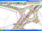
An inventory survey of 510km roads in Portsmouth was started in January 2009 and is on target to be completed summer 2009. The GeoGrad data collection software was used to capture the location of each inventory item by zooming to the appropriate scale of map and placing the item accurately with a stylus thereby fixing its position by visual reference to points on the map. On lengths of the network with few or no visual features, an in-built GPS receiver was used to assist the surveyors to fix their location. As part of the project a full and detailed Inventory Manual was produced to act both as a record of what was recorded and a specification for the data collection, as well as being available for use when future updates and additions are undertaken. JRCS Ltd offers this service to anyone involved in inventory data collection regardless of who is carrying out the survey work. |
|
|
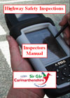
Carmarthenshire County Council has now published a Code of Practice for Highway Safety Inspections which was prepared by John Reid Consultancy Services Ltd. The Code has been made available to elected members, professionals involved in the defence of potential claims against the County and other interested parties. It contains exact details of the County’s Highway Inspection Regime and the methodology in place to fulfil its statutory obligations under Sections 41and 58 of the Highways Act 1980. As part of the regime, JRCS Ltd has also compiled a comprehensive manual for the inspectors detailing the procedures to be followed throughout the County in order to comply with the contents of the Code. The next stage is to conduct training and confirm that each inspector is adhering to the correct working practice and issue certificates of accreditation where appropriate. |
|
|
On 16 July 2008, Rosie Winterton MP, the Minister of State for Transport announced that the Department for Transport would be making available £23 million to assist local authorities in England with developing their asset management capability with regard to their highway assets. The funding is being made available to English local highway authorities to help them develop their transport asset inventories. In announcing the funding, Rosie Winterton said:
“Asset management is not just about engineering, or finding the right technical solution at the best price. It's about ensuring the asset provides the service that the public want from it. Good asset management starts with knowing what assets you have, what condition they are in and what you want to use them for. This extra funding will help local authorities to gather and use the data they need to ensure they get the best from the infrastructure they manage.” Click here to view the full article as a pdf |

|
|
The Street Scene Section of Carmarthenshire County Council has undertaken a Condition
Survey, devised by JRCS Ltd, of the unadopted areas within their council owned housing
estates concentrating on Service Roads, Parking Areas and Footways.
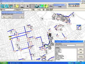
A Pilot Survey to establish the methodology and data analysis procedures was undertaken in December 2007 and the remaining survey is scheduled to start in June 2008. The data was collected using GeoGrad by locating the point, continuous and area items on the background O.S. maps. A full inventory of the required items was recorded together with Material Types, Areas of ‘Major Deterioration’, ‘Minor Deterioration’ and ‘Patching Required.’ |
|
|
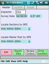
DC4 now has a number of automatic location functions based on the GPS signal it is receiving.
These range from locating the section being surveyed from its start/end co-ordinates through
to locating the nearest inventory item (Marker Post) and estimating the survey chainage.
The chainage accuracy can only be as accurate as the signal being picked up but early indications show it to be generally within 2 meters occasionally going out to 7 meters. For some work this is accurate enough but for other applications other techniques are more appropriate. Whichever way you choose to proceed, JRCS Ltd has a solution. Contact John Reid for more details or a discussion of your individual requirements. |
|
|
5 Agency Areas are now using the DC4 range of data collection software for their routine inspections.
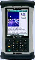
The following versions have been supplied: DC4Inspec for Safety, Non-specialist Detailed and Specialist inspections DC4Invent for Inventory collection and update DC4Light for Lamp Scouting Also available are options for electrical testing, specialist sign surveys and daily safety patrols. All software operates on Windows Mobile 6 devices such as the TDS Nomad (shown to the right) and has options for integrated GPS location and linked Defect Photographs. |
|
|
John and Stephan attended the 2007 Traffex exhibition at the NEC in April.
Present for all three days as part of the Steanne Solutions stand, the
team was displaying the full range of the DC4 data collection software
and GeoMM data management products.
Also on the stand was the Toughbook roadshow vehicle on loan from Panasonic. Our thanks to everyone who called to see the products and we hope we can do business with you in the near future. |

|
|
Bournemouth Borough Council has added the GeoMM Inventory module to its
established GeoWorks systems and is loading data collected using video
techniques supplemented by a backup walked survey to fill in the gaps.
GeoMM will enable them to view the data on a map background and produce quantified and other reports. The capability for asset valuation is available to them once the costing algorithms have been fully defined. |

|
|
JRCS Ltd is collecting a map-based, detailed highway Inventory throughout the
London Borough of Ealing using GeoGrad. The data is being managed internally
through InvUtil and GeoMM (both JRCS Ltd products) and is being supplied to
the client as MapInfo layers. Three teams of surveyors started work in December 2006
and the 592 kilometer survey will be completed by June 2007.
|

|
|
If you have ever undertaken an inventory survey and needed to record a sign’s Diagram Number as
part of the data, you will know how complicated this can be on occasions. With the Traffic Signs
Regulations and General Directions 2002 weighing in at about 2 stones, it is totally impractical
to carry this tome out on site and surveyors are reduced to making lists of commonly occurring
signs which soon become dog-eared and have been known to be blown away never to be seen again.
The 'Sign Finder' utility though simple in concept is a real boon and now available in several
formats.
|

|
Click Here to Download the Sign Finder Demonstration Version for Windows (ZIP file format)

|
|
You will see from the article in the 19 October 2006 edition of Surveyor magazine
(page 16) titled ‘Charting Progress’, that the Isle of Wight council has collected a
full and detailed inventory of their highway assets (over 147,000 point records
translating to 110,000 inventory items). The data was collected by John Reid Consultancy
Services Ltd between May and September 2006 on Panasonic Toughbook mobile computers to
position the details onto Ordnance Survey maps based on their MasterMap series. The council
requires this information to form an integral part of their multimillion-pound bid for
private-finance initiative (PFI) funding for highway maintenance.
|

|
|
Highway Maintenance Management (HMM) has implemented the GeoMaintenance suite of programs
from Steanne Solutions including GeoGrad for data collection, GeoMaintenance Manager for
Inspections and GeoWorks for works ordering and street lighting.
|

|
They are introducing the new technology in stages concentrating initially on Safety Patrols, Lane Availability Monitoring and Safety Inspections and are hoping to introduce the inventory module in the near future when they have some suitable data. All of their procedures from data capture through works completion are map-enabled.
|
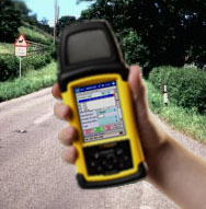
Amey Mouchel at Area 13 has used DC4Invent for while and have been so pleased with software
they commissioned a customised version for their Routine Inspections. DC4Inspec has been linked
to a Socket blue-tooth GPS and camera built into their Recon 400 data capture computers so that
the co-ordinates of defects are recorded together with an optional linked photograph of the defect.
The data is output in a format suitable for them to directly load it into their in-house database.
Their Highways Asset Manager, Mark Bulman says ‘We are really pleased with the software. It is far better than we ever expected and easy to use’. They are now embarking on their third application for road lighting, again involving an existing in-house database. |
|
|
A new Code of Practice for Highway Safety Inspections has been completed for Carmarthenshire County Council (CCC).
Presented in a 15 page A5 booklet, this document outlines the procedures adopted by CCC in their highway inspection
regime and is intended for the general public, elected members and other interested parties. By adhering strictly
to the contained procedures, CCC can readily defend claims against the County and expect to reduce their costs by
more than 1 million pounds each year.
Work is now ongoing to finalise a more detailed version which will serve as a Highway Inspection Manual for the various inspectors in Carmarthenshire and to introduce a formal Training and Accreditation Records system (TRAC Record) so that the competence of each individual can be demonstrated should the need arise during a claim. |

|
|
The Routine Maintenance Management System (RMMS) has been around for 22 years.
Originally developed for the Highways Agency (HA) in 1984 it has been the basis
for all Chainage-based inventory surveys undertaken since then and is only just
now being superseded by map-based techniques.
|

|
|
It is absolutely True that:
JRCS Ltd systems have all the functionality of other competing systems. JRCS Ltd software is better and cheaper than all of its rivals. JRCS Ltd packages are delivered populated with data and ready to use. JRCS Ltd deliver at the price agreed and on time. Yes it is absolutely true that you only pay for what you get. Check our track record and see we haven’t failed yet. |

|
|
It includes a quality control sheet, personal details, educational and professional records, work
history, training details together with supervision and spot-check history, reports of all work
undertaken during a financial year and a summary of any claims or court appearances in which an
inspector has been involved. The package is offered by JRCS Ltd either independently or together
with a tailored supervision, checking and accreditation service.
|

|
|
Whilst many London Borough’s are paying in excess of £3M per annum to settle the claims made against
them, the London Borough of Ealing has reduced its annual liability to less than £400K because of
its use of I-Browse, a fore-runner of GMM, as its chosen management system. Operated by their
long-term consultant Mouchel Parkman, I-Browse is in everyday use by inspectors and is used to log
all inspections and defects found.
|

|
|
JRCS Ltd has recently completed an inventory survey of all roads in Redcar & Cleveland (725 km)
recording their key data in graphical format using GeoGrad with an in-built GPS receiver. The
survey took 3 months to complete and embraced the key inventory items including gullies, signs,
nameplates and safety barriers.
|
|
Click here to Download the Case Study (Adobe PDF)
|
The key aspects to successfully defending claims are:
|

|
JRCS Ltd has produced a document which considers the formulation of such a training regime with a view to producing documented ‘fit for purpose’ employees and appropriate records of their relevant training and experience. This is available to interested parties as a free download from this website. Click Here to Download
|
Blackpool Borough Council has started using GeoMaintenance Manager on their Parade areas and will be expanding its use onto Parks and ultimately their full highway network providing of course they are satisfied with the findings of the trial. They are already seeing the benefits of using the system in conjunction with their GeoGrad map-based data collection software, viewing the collected details on maps of their network and building their works orders automatically so that they can be quickly viewed and authorised. |

|
|
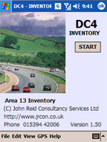
It is very likely that with Asset Valuation looming in 2006 and the requirement for
an up-to-date Asset Register, that this year will be heavily biased towards
Inventory Data Collection and Processing. |
|
|
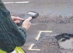
In order to help you with your Highway Asset Management Plans, John Reid Consultancy Services is pleased to offer you the use of
its Inspector Calculator spreadsheet tool. Enter your network details, proposed inspection frequencies and your estimated
survey rates and the Calculator will tell you how many inspectors you need. Try different combinations to see what effect different
policies will have.
Click here to Download |
|


